Special Project
Wolcott Pond Initiative
The mission of the Wolcott Pond Watershed Initiative is to conserve and protect Wolcott Pond, its shoreline and watershed, and some wild and undeveloped lands surrounding the watershed.
In 2018 the Northern Rivers Land Trust identified the beautiful and diverse Wolcott Pond watershed as critical to protect. So that year the NRLT board began to investigate past and current land use and conserved land in the area and identify landowners with a potential interest in conserving their properties. In 2020 directors initiated formal steps with landowners to establish conservation easements on 100 acres abutting the pond. When completed, the easements will create approximately 2,500 feet of newly protected shoreline owned by members of the Young/Roy family.
This report is designed to deepen scientific information available to the public about the pond and its watershed and help landowners and the public to understand their value and the NRLT’s conservation efforts to protect the landscape.
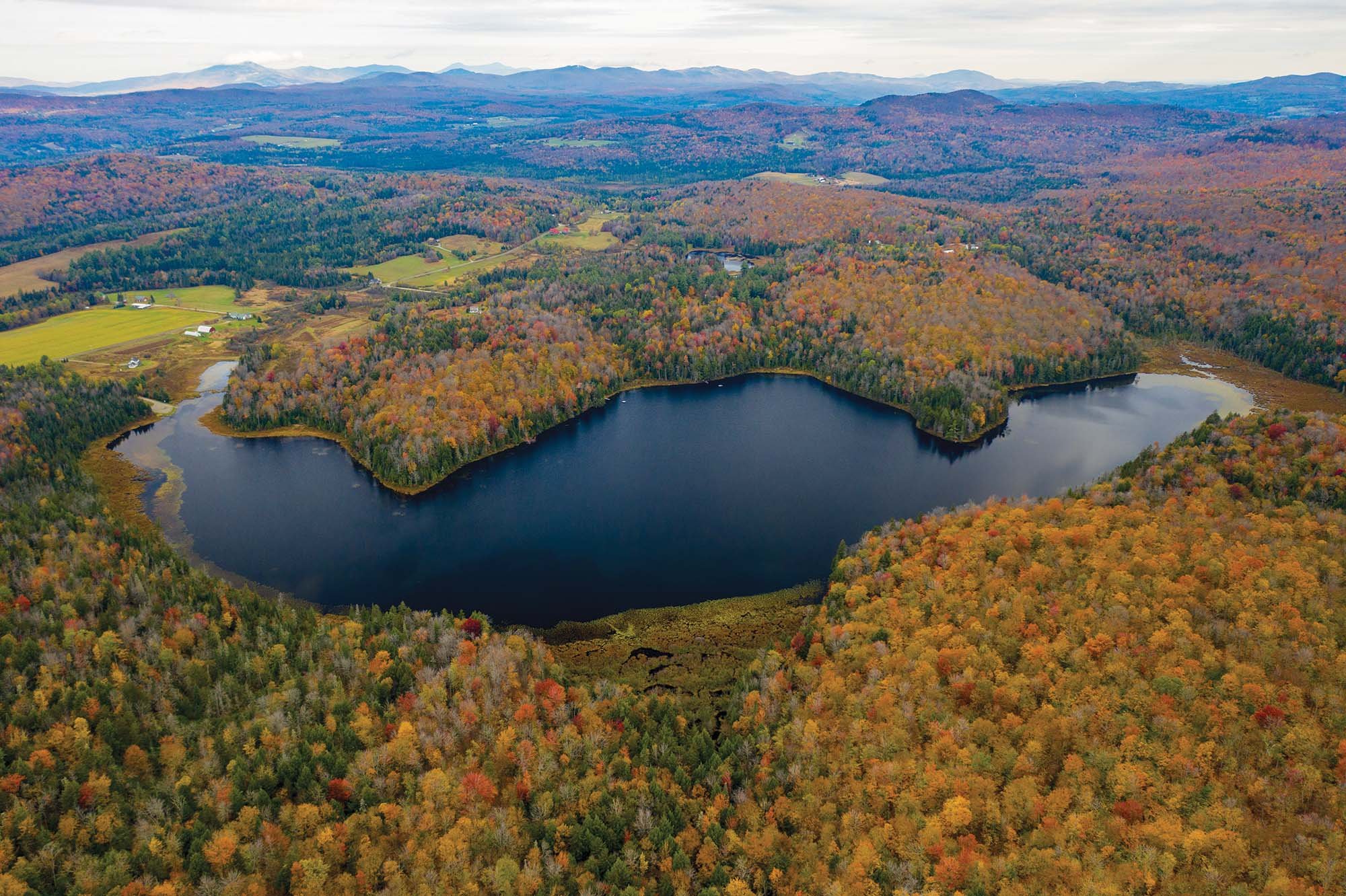
Significance of the Watershed
Wolcott Pond is located in the Lamoille River watershed, which covers more than 700 square miles until the river meets Lake Champlain. The Wolcott Pond watershed is itself approximately 831 acres, or 1.29 square miles (Figure 1). It is dominated by forested land and held by 23 landowners, and land uses include farming, logging, recreation, and residential, both full time and seasonal. The semi-wild, 73-acre pond is reached from East Hill Road in Wolcott at a Vermont Department of Fish and Wildlife fishing and boating access.
Conservation of the pond and watershed is critical for three reasons: connectivity to nearby conserved areas such as the Bear Swamp complex and East Hill Wildlife Management Area; a largely intact wild shoreline that enhances water quality in the pond and the Lamoille River watershed; and protection of noteworthy populations such as common loons and wild azaleas.